There are areas of the vice county that have no or very few records. These are represented below as the white gaps in the map. Where possible we would like to fill in these gaps to help us have a more complete understanding of the county’s flora.
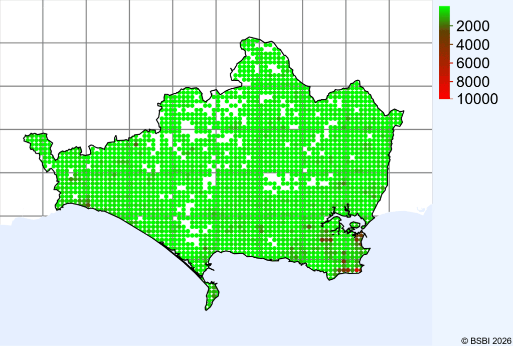
A list of monads and the number of verified records is also available here: Under-recorded Monads

